
Tectonism and climate changes during the Quaternary have shaped the present-day landscape of Northern Switzerland (Chapter 3, Sections 6.2 and 6.3). The main erosion processes that are involved are the combined action of rivers and especially the drainage evolution of the Aare – Rhine River system, as well as erosion and sedimentation by repeated large foreland glaciations. These processes, in turn, control topographic slopes and mass movements, thus driving denudation of the topography.
The respective landscape forms derived from fluvial incision, evolution of hillslopes, and deep glacial erosion provide important geomorphic reference markers (Schnellmann et al. 2014). These markers allow the landscape to be divided vertically into different geomorphic compartments. Based on these markers, the geomorphic constraints at the respective repository sites can be determined and an assessment of future erosion made (Section 6.4.3). In the following, the three compartments and the main differences affecting the siting regions are briefly described (for more details see Nagra 2024k).
The main reference horizon, i.e. first landscape compartment, constitutes the local erosion base – the locally deepest fluvial incision level in bedrock (Fig. 6‑18b). The local ersosion base is a virtual surface that is spanned between the thalwegs of the main river channels of the Rhine, Aare, Limmat, and Reuss and declines towards WNW. Some of these thalwegs are filled with sediments so that the bedrock interface defines the thalweg depth, and the local ersosion base is lower than the present-day river bed (see Pietsch & Jordan 2014 for more details14). No local river can significantly incise below this level. The local erosion base affecting the siting regions is gently inclined towards the WNW and is mainly defined by the paleochannels of the Rhine, Aare, Limmat and Reuss Rivers (Fig. 6‑18b). The Quaternary fluvial incision history of Section 6.4.1.2 describes the past evolution of the local erosion base.
The local erosion base (LEB) separates the rocks (bedrock and unconsolidated sediments) above (here called local topography, Fig. 6‑18c) from the unconsolidated Quaternary sediments that fill the glacially overdeepened basins (glacial overdeepenings, Fig. 6‑18d) below.
Section 6.4.1.3 describes processes and rates that reflect the evolution of local topography in selected areas of Northern Switzerland and Section 6.4.1.4 summarises the Quaternary glacial history that led to deep glacial erosion and overdeepened basins. More details can be found in Nagra (2024k).
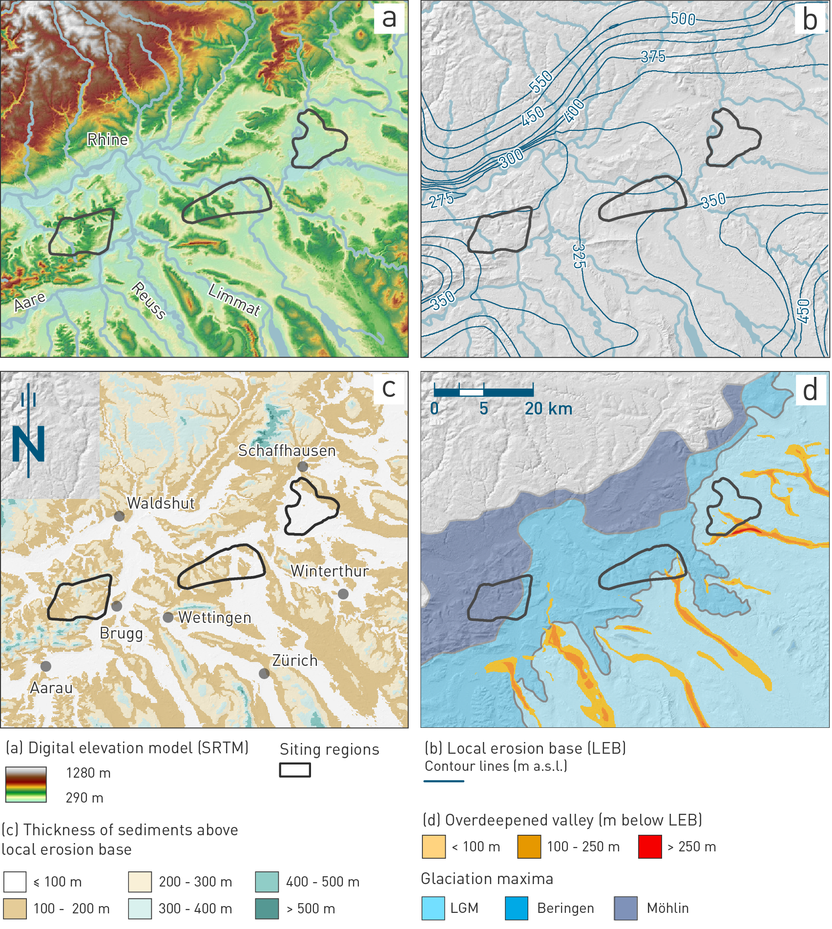
Fig. 6‑18:Maps showing the main landscape compartments around the siting regions
(a) Digital elevation (NASA Shuttle Radar Topographic Mission SRTM, Digital Elevation Model) on a hillshade model showing the relief distribution around the siting regions and main rivers. (b) Contours of local erosion base (LEB) as derived by Pietsch & Jordan (2014). (c) Colour-coded thickness of local topography, i.e. the sedimentary rocks and unconsolidated Quaternary sediments above the LEB. (d) Ice extents of the three Quaternary key glacials (blue colours, see Section 6.4.1.4) and distribution and depth of glacial overdeepenings (orange colours). The siting regions are plotted in each subfigure for comparison.
The present adaptations on the bedrock model (version 2023) did not change the elevations of this reference. ↩