
The Hauptrogengestein is the nearest aquifer above the Opalinus Clay in the JO siting region. The flow system is affected by the local topographic situation and by the facies transition towards units with higher clay-mineral contents towards the east (Sections 4.2.7 and 4.5.3.6).
Potential recharge areas are the outcrops located north and west of the siting region (Fig. 4‑100). The location of the discharge areas depends on the assumptions regarding the continuity and properties of the aquifer. Assuming that the permeable facies reach the lower Aare Valley to the east, discharge mainly occurs along the Aare River and, to a lesser extent, in the Quaternary aquifer of the Sissle Valley to the west.
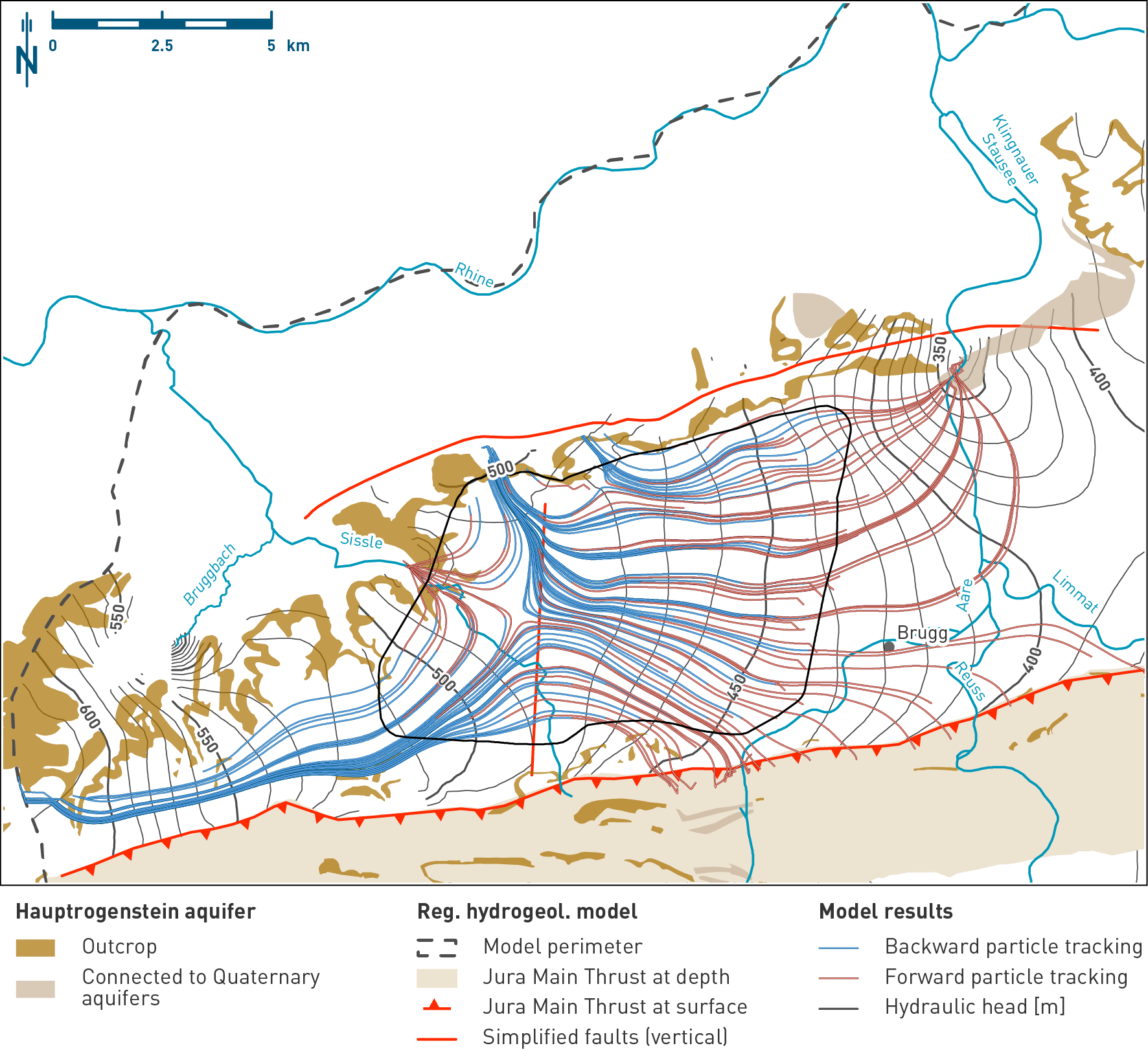
Fig. 4‑100:Simulated hydraulic heads and particle paths identifying recharge and discharge areas in the Hauptrogenstein aquifer
Hydraulic head situation at the top of the Hauptrogenstein aquifer of the hydrogeological model. The map shows the outcrops and the simplified regional fault pattern used in the model. The displayed particle paths are a 2D projection of the 3D particle traces. Note the west to east orientation of the groundwater flow. Particles that stop close to the eastern boundary of the site do not display any further displacement as they are trapped in the overlying low permeability formation (see discussion in Nagra 2024n).