
This section characterises the hydrogeological unit between the Opalinus Clay and the Keuper aquifer, i.e. the Staffelegg Formation and the uppermost part of the Klettgau Formation (in SGT Stage 2 termed ‘clay-rich Keuper’). The unit includes important lithological variation in the vertical direction but shows good lateral correlation on the regional scale (Section 4.2.5 and partly 4.2.4). The lithologies mainly comprise dolomitic marls, limestone beds with individual thicknesses of less than 5 m and clay-mineral-rich intervals with good self-sealing properties (Fig. 5‑3).
A focus of the in-situ hydraulic testing was on the Staffelegg Formation because of its position directly below the Opalinus Clay (Fig. 4‑85). The observed hydraulic conductivities are generally ≤ 10-11 m/s, with the majority of the best estimate values being < 10-12 m/s (Fig. 4‑93). The comparison with matrix hydraulic conductivities suggests that some tests were affected by fractures. The highest value relates to an interval that includes fractures in the Beggingen Member (BAC1/LIA1 T = 2 × 10⁻¹⁰ m2/s). The low hydraulic conductivities are supported by the absence of relevant anomalies in the profiles of the natural tracers (Section 4.6). These observations show that this unit is part of a low-permeability sequence in which diffusion dominates mass transport.
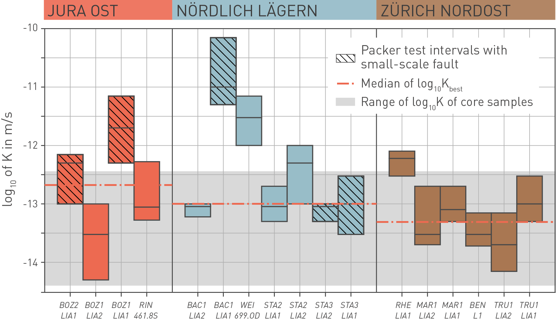
Fig. 4‑93:Results of in-situ hydraulic packer tests in the Staffelegg Formation and comparison to values from laboratory tests on drill cores
The best estimate of the hydraulic conductivity is displayed with a thick black line. The associated uncertainty is shown with the vertical extent of the bars. The range of matrix hydraulic conductivity is shown in light grey (11 measurements).
For the recent TBO boreholes, the figure indicates test intervals that include small-scale faults. Note that no such detailed structural inventory is available for the historical boreholes Riniken (RIN) and Weiach (WEI).