
The «Herrenwis Unit» occurs only in the eastern part of NL, as a ca. 40 m thick isolated carbonate platform that is embedded into clay-mineral-richer units above and below and also laterally (Section 4.2.7, Fig. 4‑41). This unit is characterised by a substantial variability along the boreholes and also within an individual core section (Fig. 4‑36). At the CT-scan scale, carbonate and clay-mineral-rich zones can be identified and isolated macroporosity can be shown (Fig. 4‑90). These observations and the complex internal architecture of this unit show that a substantial variability of matrix permeability must be expected.
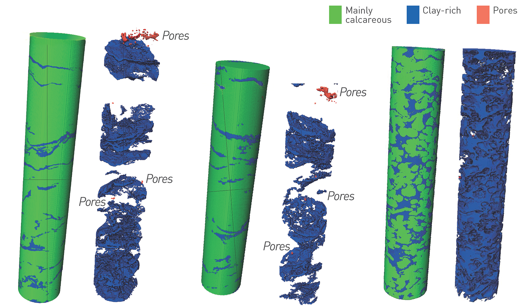
Fig. 4‑90:«Herrenwis Unit» of the BUL1 borehole: CT-scan-based visualisation of mainly calcareous and clay-mineral-rich zones and macropores
Drill core diameter is 95 mm. Displayed are core samples BUL1-1 816.60 GM, BUL1-1 818.55 GM and BUL1-1 842.10 GM (number denotes the depth of the top of the core section).
The hydraulic conductivities from the in-situ testing in the BUL1 and STA3 boreholes are very low (< 10-11 m/s;Fig. 4‑92). This probably relates to the burial history (mechanical and chemical compaction) and the absence of relevant dolomitisation or of dissolution-enhanced hydraulic conductivity. A higher conductivity was observed related to a sub-vertical joint (Fig. 4‑92) in the basinal part (periplatform wedge, Section 4.2.7) drilled by the STA2 borehole (3 × 10⁻¹⁰ m/s). Hydraulic heads lower than the potential discharge area (Fig. 4‑91) are a strong argument in support of the hydraulically isolated nature of the «Herrenwis Unit» (for a detailed discussion see Section 5.6.5). The profiles of the natural tracers in porewater, in particular Cl and Br, are affected by increased scatter in this heterogeneous low-porosity unit. The profiles of the stable isotopes, the Br/Cl ratio and 4He that are considered most robust in this unit do not show significant excursions (Section 4.6).
To conclude: The «Herrenwis Unit» is an isolated carbonate platform embedded in clay-rich rocks. There are no indications of an active aquifer, e.g. it has no direct recharge or discharge areas. Hydraulic conductivities are low for the tested lithofacies but may be debatable given the heterogeneity of this unit. However, the hydraulic properties of the unit may locally be influenced by tectonic overprint as indicated by the test in the STA2 borehole.
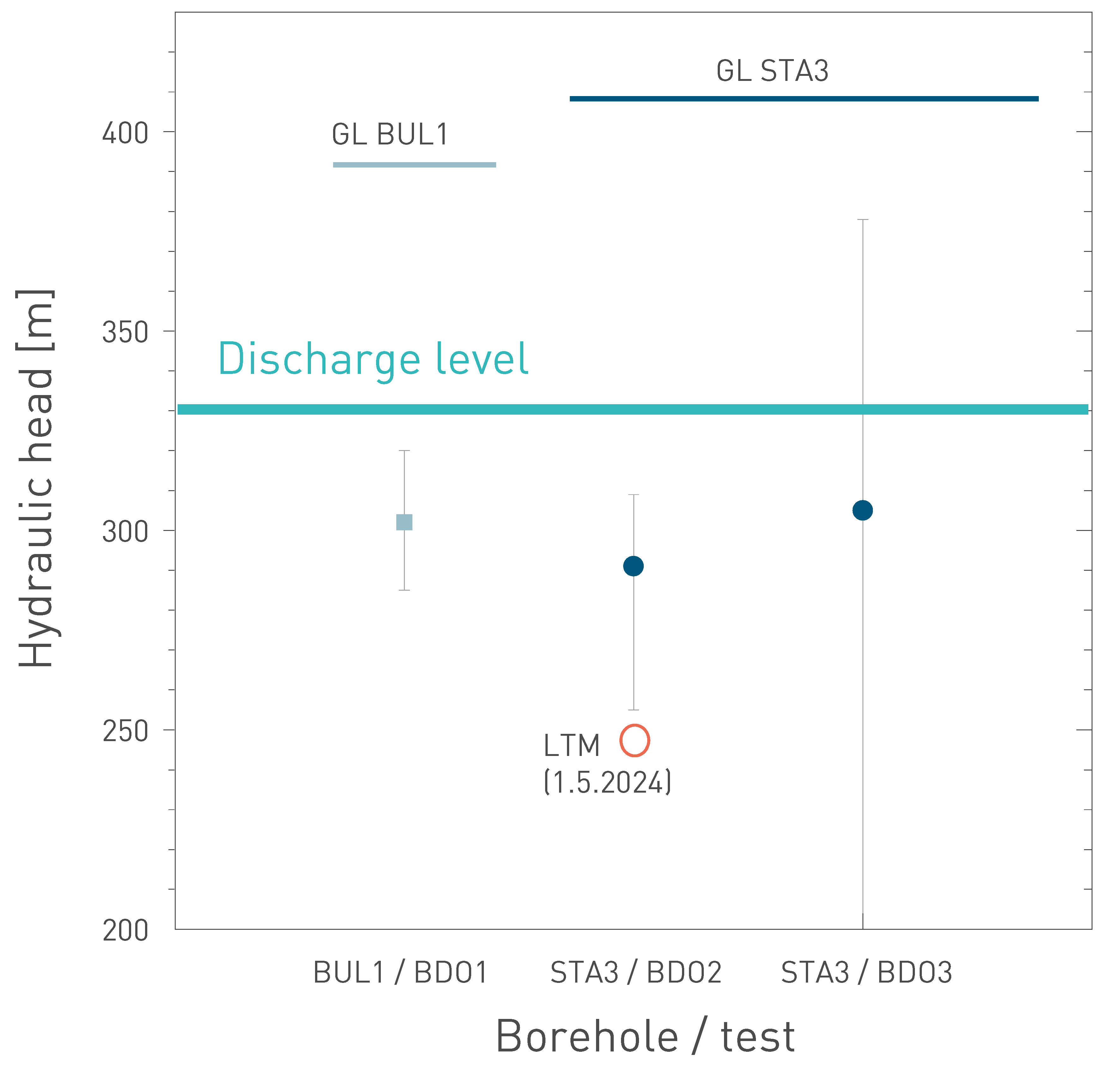
Fig. 4‑91:Hydraulic heads in the «Herrenwis Unit» observed by packer testing and comparison with data from the long-term monitoring system (LTM) in STA3
The data are compared to the ground level (GL) of the drillsites and to the altitude of the potential discharge area along the Rhine River (Section 4.5.3.3, Malm aquifer). The figure shows the results from packer test intervals (almost) completely located within the «Herrenwis Unit». Tests are not shown if the intervals include important parts of other formations (STA2-BDO2, BUL1-BDO2). See also Fig. 4‑85.
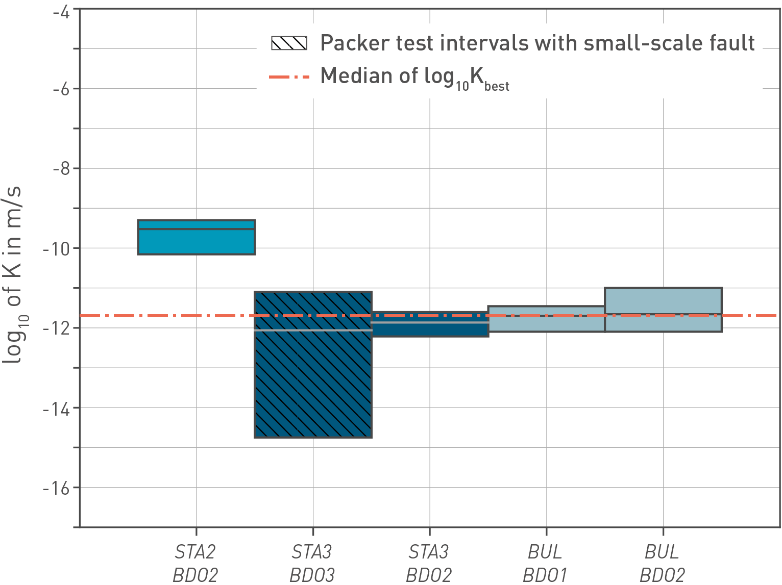
Fig. 4‑92:Hydraulic conductivity from in-situ hydraulic packer tests in the «Herrenwis Unit»
The test interval STA2/BDO2 includes a sub-vertical joint.